I grew up on Tratman Avenue (2515; Apt. H53) two blocks west of Westchester Square in the East Bronx, just a few blocks from Westchester Creek and 1 block north of the old St. Peter's church. The time-frame was 1960 to late 1978, from age 3 to 21.
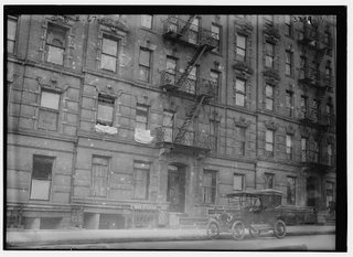
Our 2-bedroom apartment was on the top 5th floor (no elevator), facing Overing Street and Westchester Square.
The rectangular-shaped structure (resembling an aquarium when viewed from above; try it on Google Earth) comprised of a courtyard with 3 separate fenced-in gardens (never very well maintained) and 8 walk-up stoops/buildings.
There were still a few pockets of undisturbed nature left in this area that was long-ago farmlands, marshes, and creeks: St. Peter's cemetery along Westchester Ave; the chestnut and other trees behind the Huntington Library, seen from the east side of Overing St., and the maple and elm trees and tulip gardens at Westchester Square.
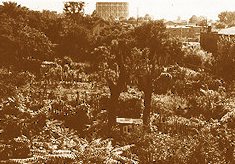
Several blocks east of Westchester Sq, on the block immediately south of the Zerega Ave. subway station--on the west side of Zerega--once existed a small sunken creek/marsh that my friends and I explored, circa 1970.
This photo is looking toward the Cross Bronx Expressway from the Zerega Ave subway station on Westchester Ave. During World War II it was used as a victory garden.

It was a very shady spot in the summertime, and there were bunches of tadpoles in the algae-covered water.
Some have called this the Seabury Creek. I do not know if an underground stream fed the creek or not; water collected from rains/snow that fell on the sunken area.
More info on this creek here.
It's a shame this quaint little area was lost due to development.
Westchester Creek is where things were really verdant, easily accesible at the time by walking down a path from E. Tremont Ave. This northern end of the creek has been filled in with the construction of Lehman High School. At the time, you could walk along the creek from here all the way to Ferry Point Park if you wanted to, if you didn't mind seeing rats scurrying along abandoned barges or thru the thick reeds.
The creek seemed to end at the foot of the Tremont Avenue bridge, but it barely snuck beneath the bridge thru conduits for a peek on the north side of Tremont.
According to a 1897 survey map of New York City that shows the existing wetlands/creeks in the Bronx, Westchester Creek at that time continued all the way up beyond the New York/New Haven (now Amtrak)train tracks, and ended just north of where Pelham Parkway is now. This part of the creek was filled in with the construction of Bronx State Hospital and other nearby development.
One of the largest Bronx wetlands eliminated by growth was where Freedomland amusement park once stood in the 1960s. One winter when I was about 11, my older brother and some of his friends brought me up to an area to the west of Freedomland and we walked across a large open area of thick ice. It was so thick that there was no danger of falling thru it. This was a fresh-water marsh, though salt marshes were not too far away further south down the Hutchinson River. Looking back, we must have explored the area much like Mohicans searching for food and wood.
In the late 1960s, Freedomland was razed and many other acres of wetlands were wiped out by the development of Co-Op City.
Co-Op City was built between 1968 and 1970 over what had been Givans Creek, a low-lying wooded wetland. Gone were clusters of oak and hickory trees, surrounding meadows, and rocky outcrops covered with mosses and lichens.
The only remnant today of that wetlands is Givans Creek Woods, which is bounded by the New England Thruway and Tillotson Avenue on the west.


